WEATHER ALERT
ENVIRONMENT CANADA
**************************
Special weather statement in effect for:
- Barrie - Collingwood - Hillsdale
- Midland - Coldwater - Orr Lake
- Orillia - Lagoon City - Washago
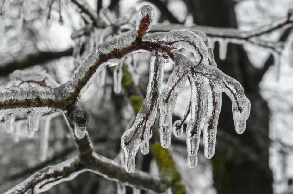
Some freezing rain possible Thursday morning. Potential ice storm for parts of southern Ontario Saturday and Sunday.
A fast-moving low pressure system will cross Southern Ontario Thursday bringing an area of rain with it. The precipitation may start as freezing rain early in the morning before quickly changing to rain as temperatures rise above the freezing mark.
Any freezing rain should be fairly brief near the Highway 401 corridor, but may persist for a couple of hours for regions farther north and especially over higher terrain. Locally slippery conditions are possible. Closer to the Lake Ontario shoreline, only rain is expected.
A much more significant freezing rain event is looking increasingly likely for portions of southern Ontario Saturday and Sunday as a slow-moving low pressure system approaches the area.
Precipitation may start as rain, but increasing northeasterly winds will draw colder air from an arctic high pressure system to the north, resulting in a changeover to freezing rain. A few rounds of precipitation are likely during this period with a significant threat of prolonged freezing rain in some areas.
At this point, there is still considerable uncertainty with regards to which areas may be most affected. Areas closer to Lake Ontario and near the Highway 401 corridor may remain just above the freezing mark much of the time limiting the amount of icing somewhat. Areas farther north and over higher terrain are likely to be impacted the most.
This has the potential to be a major ice storm for some regions with ice accumulations in excess of 20 millimetres possible. Ice accumulations of this magnitude combined with gusty winds to 60 km/h may result in widespread power outages due to fallen tree limbs and power lines. Travel is also expected to be hazardous.
Please continue to monitor alerts and forecasts issued by Environment Canada. To report severe weather, send an email to [email protected] or tweet reports using #ONStorm.
**************************


